Treviiok RAMS combines dashcam or vehicle-mounted video, GPS, AI analytics, GIS, asset inventory and maintenance workflows to create a continuously updated view of road conditions, defects and maintenance priorities.
+91-000000000

RAMS

ROAD ASSET MANAGEMENT SYSTEM
FROM PERIODIC INSPECTION TO CONTINUOUS ROAD ASSET INTELLIGENCE

CONTINUOUS ROAD & ASSET SURVEY
Use designated or existing fleet vehicles to capture road and roadside conditions through video, GPS, route and timestamp data.
Route Scheduling
GPS & Timestamp Capture
Coverage Tracking
Evidence Retention
Offline Data Buffering
AI-BASED ROAD & CIVIC ASSET ANALYTICS
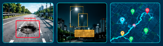
Computer vision identifies road defects, asset-condition issues and civic maintenance observations, with every detection geo-referenced and linked to visual evidence.
WHAT CAN BE IDENTIFIED
Road Surface
- Potholes
- Cracks
- Rutting
- Surface deterioration
- Footpath and road-edge damage
Drainage & Water
- Waterlogging
- Drain cover and slab damage
Markings, Signs & Kerbs
- Faded markings
- Damaged signage
- Damaged kerbs
- Missing roadside assets
Lighting
- Non-functional streetlights
- Dark stretches
Roadside & Environment
- Vegetation overgrowth
- Debris
- Roadside obstruction
- Garbage hotspots
Compliance & Context
- Unauthorised median cuts
- Work-zone barricading
- Encroachment
- Illegal-parking context

KNOW EVERY ASSET & HOW IT HAS CHANGED
Build a digital history of road assets and defects to track condition over time, identify recurring faults and understand deterioration.
AUTOMATED TICKETING & MAINTENANCE WORKFLOW
Turn validated AI observations into accountable maintenance actions.

MANAGEMENT INTELLIGENCE & PLANNING
Turn field observations and maintenance activity into actionable management intelligence.
Defect Hotspots
SLA Performance
Repeat Faults
Contractor Performance
Survey Coverage
Maintenance Backlog
MAKE YOUR INFRASTRUCTURE SMARTER
Tell us the problem. We’ll show you what your existing infrastructure can already do.